

The InnerSpace sensor is the first of its kind in the IoT/indoor location market. It captures a massive amount of data including location, positioning, and 3D data so that we can provide businesses with traffic metrics, patterns, and predictive modelling. This data - and its fancy math - mean we can use the information to fundamentally change how buildings operate and how people work.
One of the questions we often get asked is what is LiDAR and how do we use it?
LiDAR, or Light Detection and Ranging, is a sensor that measures distance to a target by sending out pulsed laser light and measuring the reflected pulses that come back. LiDAR can detect objects comprised of almost any material - metal, wood, textile, even down to a single molecule. Digital 3D representations of an object are created based on the differences in laser return times and the wavelengths that are generated. We use this information to create maps and 3D models of buildings, rooms, and the objects - like tables and chairs - within them.
Fun Fact: LiDAR is the same technology that was used by NASA to scan the Shuttle Discovery to ensure it could safely return to Earth.
But why does InnerSpace use LIDAR?
One of our goals at InnerSpace, is to make the process of enabling location intelligence as simple as possible for our customers. You see, traditionally to get maps and location and positioning and cobble it all together is very expensive, time consuming and complicated. And once deployed, if you want to change anything? Total nightmare! We wanted our technology to be super easy to deploy and easily scalable for our clients. No professional services, no cobbling technologies together. Simple. Install & Go!
To do this, we needed a way to generate a map of the space easily. We also need to know what is in the space - walls, chairs, tables, etc. We investigated a number of different technologies including sonar, radar, and imaging. We ultimately chose LiDAR for its better range and accuracy - LiDAR’s range is large (40m) and is very accurate (+/- 10 cm).
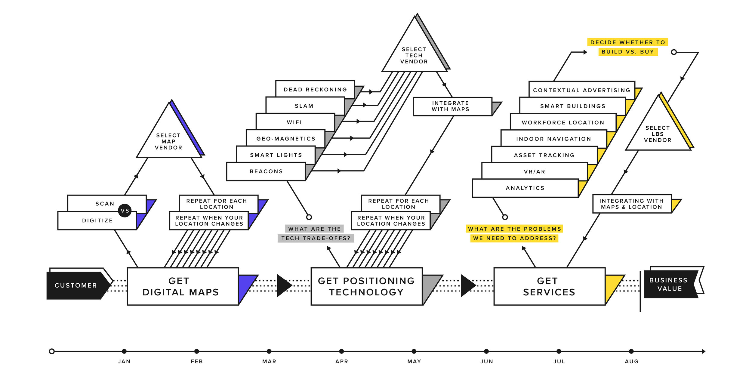 Historically, indoor location deployments have been complex, involved a multitude of technologies and vendors, and resulted in a fragile architecture that couldn’t scale.
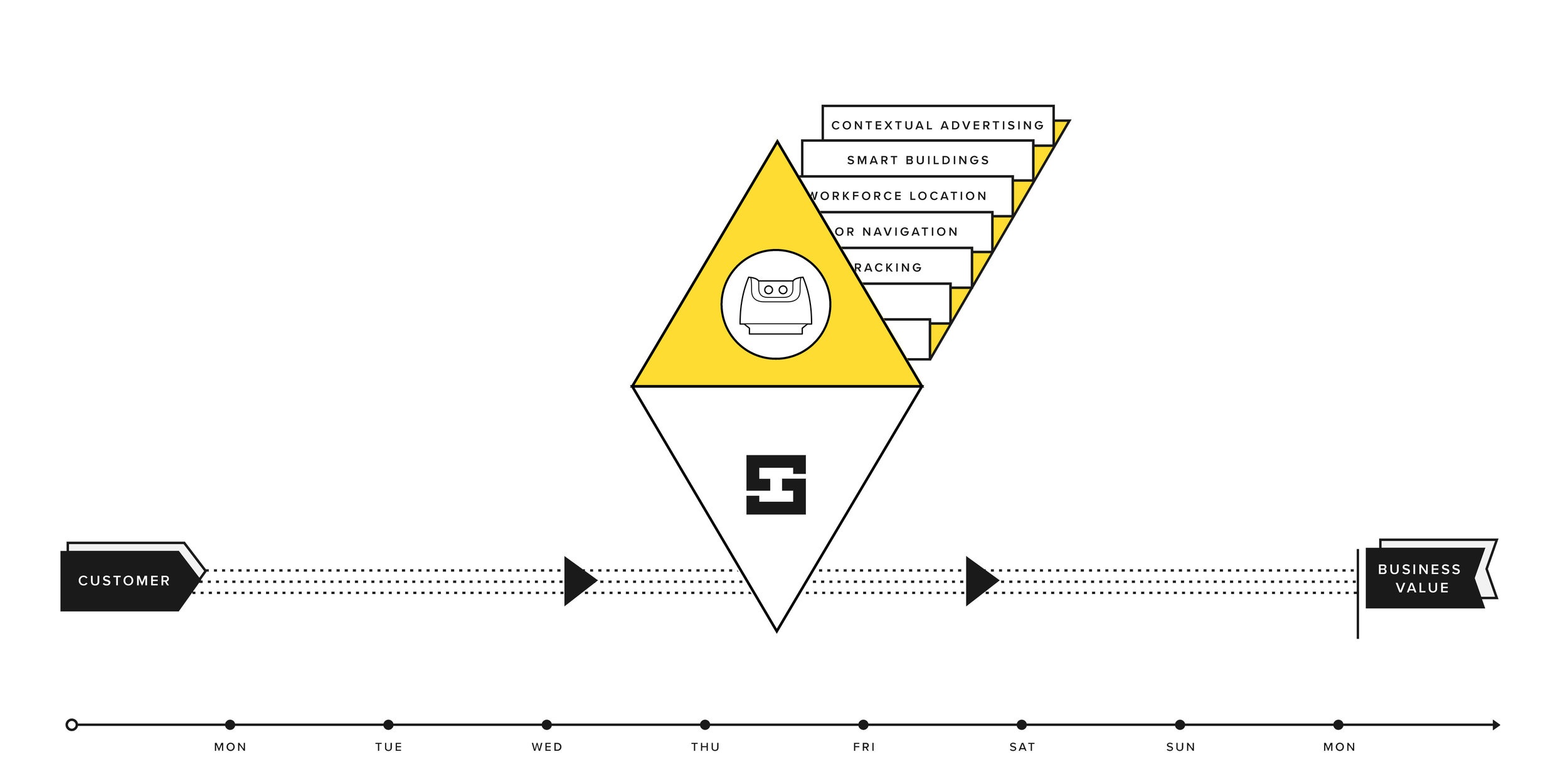 We created the first plug-n-play sensor that makes indoor location easy to implement. Most of our clients are up and running in just 1 day.
With LiDAR, each InnerSpace sensor generates a 'point cloud', which is a set of thousands of angle and measurement pairings. From this point cloud, our inFINITY platform applies algorithms to transform this data into walls, doors, chairs, tables, walls, plants, etc. With these maps and models, we can then assign location to identify patterns, provide navigation, and deliver operational intelligence to our clients.
Check out the detail LiDAR offers.